Measure. Map. Master the Land. At New Pak Technical Training Centre, our Civil Surveyor Course transforms beginners into skilled land engineers. From handling chains, compasses, and theodolites to Total Stations and GPS, you’ll gain hands-on expertise in surveying, contour mapping, and construction layout. Learn to translate field data into precise maps and digital drawings with AutoCAD, preparing you for high-demand careers in Pakistan and the Gulf. Train on real sites, perform professional measurements, calculate quantities, and master modern surveying techniques to become a confident Civil Surveyor ready to tackle roads, buildings, and bridges.
Course Overview
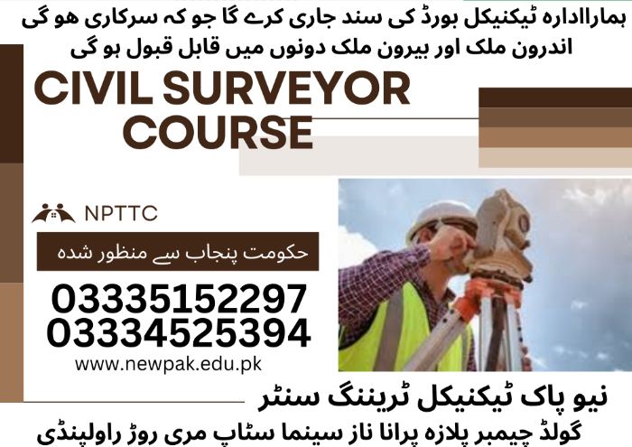
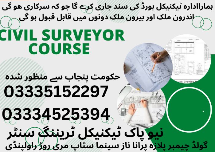
A Civil Surveyor is the first person to arrive at a construction site and the last to leave. At New Pak Technical Training Center, we offer a highly practical Civil Surveyor course that prepares you to measure land, determine boundaries, and provide critical data for roads, buildings, and bridges. We bridge the gap between field work and engineering design.
Why Choose Our Civil Surveyor Program?
Advanced Equipment Training: Hands-on practice with Total Station, Auto Level, and Theodolite.
Real-World Field Work: Students perform actual site surveys, topographical mapping, and leveling exercises.
Gulf Career Ready: One of the most respected and high-paying trades for overseas employment in Saudi Arabia, UAE, and Qatar.
Data Integration: Learn how to transfer field data to computers for engineering analysis.
Detailed Course Modules
06 | Months Certificate
Focus: Mastering the tools and basic leveling.
Introduction to Surveying: Understanding units, chains, tapes, and compass surveying.
Leveling Mastery: Professional use of the Auto Level to determine elevations and contouring.
Angle Measurement: Using the Theodolite for horizontal and vertical angle calculations.
Topographical Survey: Mapping the physical features of a land area.
01 | Year Certificate
Focus: High-precision digital surveying and mapping.
Total Station Mastery: Complete training on digital Total Stations for distance and coordinate measurement.
Digital Mapping: Learning to plot field coordinates into AutoCAD to create survey maps.
Road & Bridge Surveying: Setting out curves, embankments, and structural alignments.
GPS Surveying: Introduction to Global Positioning Systems (GPS) for large-scale land measurement.
Frequently Asked Questions (FAQs)
Do I Need a Background in Engineering to Join?
No. We start from the absolute basics of measurement. Students with a Matric or Middle school background can successfully become professional surveyors.
Is The Certificate Valid for Gulf Jobs?
Yes, the technical training provided at New Pak is recognized by employers and recruitment agencies for international construction projects.
Will I Learn AutoCAD in This Course?
Yes, the 1-year diploma includes training on how to convert your field survey data into digital drawings using AutoCAD.
Month 1 — INTRODUCTION TO SURVEYING
Theory Topics
1. Introduction To Civil Surveying
Definition, scope, and importance of surveying
Role of a Civil Surveyor in Pakistan
2. Types Of Surveying (Plane & Geodetic)
Differences between plane and geodetic surveying
Applications in projects
3. Units Of Measurement
Standard units used in surveying (Length, Area, Volume)
Conversion techniques
4. Surveying Terminology
Common terms and definitions
Understanding field and office terms
5. Classification Of Surveys
Land surveys and applications
Route, construction, and hydrographic survey types
6. Survey Ethics And Professional Conduct
Ethical responsibilities
Accuracy, honesty, and reporting standards
7. Basic Mathematics For Surveyors
Geometry and trigonometry basics
Simple calculations for measurements
Use in fieldwork and plotting
Practical Sessions
Familiarization with surveying instruments
Measuring distances using chains and tapes
Use of metric units in field
Basic field note booking
Handling and care of instruments
Month 2 — CHAIN SURVEYING
Theory Topics
1. Principles Of Chain Surveying
Basic concept and methodology
Surveying procedure overview
Applications in small areas
2. Instruments Used In Chain Surveying
Chains and tapes
Measuring tapes for accuracy
Support equipment (plumb bob, pins)
3. Ranging Rods, Arrows, Pegs
Purpose and usage in marking
Types and materials
Placement techniques
4. Offsets (Perpendicular & Oblique)
Definition and purpose
Measurement methods
Recording procedures
5. Errors In Chain Surveying
Types: instrumental, natural, personal
Causes and detection
Impact on survey results
6. Correction Of Errors
Methods to adjust measurements
Error minimization techniques
Verification and recalculation
7. Advantages And Limitations
Benefits of chain surveying
Situations where it is suitable
Constraints and practical challenges
Practical Sessions
Chain surveying of a small plot
Ranging and offset measurement
Field book preparation
Plotting chain survey maps
Calculation of area
Month 3 — COMPASS SURVEYING
Theory Topics
1. Introduction To Compass Surveying
Purpose and applications
Basic methodology in the field
2. Types Of Compass
Prismatic compass uses
Surveyor’s compass uses
Differences and selection criteria
3. Bearings And Angles
Definition of bearing
Measuring angles in the field
Recording techniques
4. Whole Circle Bearing (WCB)
Concept and calculation
Applications in plotting
Field measurement procedure
5. Reduced Bearing (RB)
Definition and conversion from WCB
Use in survey calculations
Practical examples
6. Magnetic Meridian
Concept and determination
Difference from true meridian
Field usage
7. Local Attraction
Causes of local attraction
Effects on measurements
Correction methods
Practical Sessions
Use of prismatic compass
Measurement of bearings
Detection of local attraction
Plotting compass traverse
Correction of bearings
Month 4 — PLANE TABLE SURVEYING
Theory Topics
1. Plane Table Surveying Principles
Basic concept and purpose
Field procedure overview
Applications in small to medium areas
2. Equipment And Accessories
Plane table, alidade, drawing board
Tripod, spirit level, and sighting tools
Station markers and pins
3. Methods Of Plane Table Surveying
Radiation method
Intersection method
Traversing method
4. Errors In Plane Table Survey
Instrumental, personal, and natural errors
Causes and detection
Minimization techniques
4. Advantages And Disadvantages
Benefits of immediate plotting
Situations where plane table is suitable
Limitations in large-scale surveys
Practical Sessions
Setting up plane table
Radiation method
Intersection method
Traversing method
Preparation of site map
Month 5 — LEVELLING (HEIGHT & LEVEL MEASUREMENT)
Theory Topics
1. Introduction To Levelling
Purpose and applications in surveying
Basic concept of height measurement
2. Types Of Levels
Dumpy level and its usage
Auto level functions
Digital level advantages
3. Terms Used In Levelling
Bench mark, back sight, fore sight
Reduced level, staff reading
Height of instrument
4. Types Of Levelling
Differential levelling
Profile levelling
Fly levelling
5. Errors And Corrections
Instrumental, natural, and personal errors
Methods to detect and correct errors
Minimizing measurement discrepancies
6. Curvature And Refraction
Effect of Earth’s curvature on levelling
Refraction correction methods
Importance in long-distance levelling
Practical Sessions
Temporary and permanent adjustments
Fly levelling
Profile levelling
Differential levelling
Preparation of level book
Calculation of Reduced Levels (RL)
Month 6 — THEODOLITE SURVEYING
Theory Revision & Mock Tests
1. Introduction To Theodolite
Purpose and applications in surveying
Basic concept of angle measurement
2. Types Of Theodolite
Transit theodolite
Digital/electronic theodolite
Selection criteria for fieldwork
3. Parts And Functions
Telescope, horizontal and vertical circles
Levelling screws and tripod
Vernier and reading scales
4. Measurement Of Horizontal & Vertical Angles
Procedure for measuring horizontal angles
Procedure for measuring vertical angles
Recording and calculation methods
5. Traversing With Theodolite
Open and closed traverse methods
Plotting traverse points
Field measurement techniques
6. Errors And Adjustments
Instrumental and observational errors
Adjustment methods for accuracy
Calibration and verification techniques
Practical Final Assessment
Setting up and leveling the theodolite
Angle measurement
Theodolite traversing
Plotting traverse
Field calculations
Month 7: TACHEOMETRY & CONTOURING
Theory Topics
1. Principles Of Tacheometric Surveying
Concept of rapid distance and elevation measurement