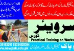
Civil Surveyor Course In Rawalpindi

Civil Surveyor Course In Rawalpindi

Civil Surveyor Course out line 6 Months 1 year:

Civil surveyor courses in Pakistan are typically offered in two formats:

  • 6-month certificate course: This is a basic introduction to civil surveying and equips students with the fundamental knowledge and skills to perform basic surveying tasks.
  • 1-year diploma course: This is a more comprehensive program that covers a wider range of surveying topics and provides students with the skills and knowledge to work on more complex surveying projects.

Here’s a general outline of what you can expect to cover in a civil surveyor course in Pakistan, depending on the duration:

Common Course Content (Both Durations)

  • Introduction to civil surveying: This includes an overview of the surveying profession, the different types of surveys, and the applications of surveying in civil engineering projects.
  • Basic surveying principles: This covers topics such as measurement techniques, leveling, traversing, and topographic surveying.
  • Surveying instruments: Students will learn how to use a variety of surveying instruments, including chains, tapes, levels, theodolites, total stations, and GPS equipment.
  • Computer-aided surveying (CAS): This introduces students to the use of computer software for data collection, processing, and analysis in surveying.
  • Fieldwork: All civil surveyor courses will include some component of fieldwork, where students will have the opportunity to apply the skills they have learned in a classroom setting to real-world situations.

6-month Civil Surveyor Certificate Course in Pakistan:

While the specific content of a 6-month certificate course may vary slightly between institutions, here’s a general outline of what you can expect to cover:

Core Subjects (Approx. 70% of Course Time):

Introduction to Surveying:

This module will introduce you to the history and importance of surveying, its role in civil engineering, and the different types of surveys conducted.

Fundamental Surveying Principles:

This section will delve into the basic principles of measurement techniques used in surveying, including:

Linear measurements using chains, tapes, and electronic distance meters (EDM)

Leveling techniques to determine elevation differences

Traversing methods for establishing control points

Introduction to topographic surveying for creating maps

Surveying Instruments:

  • You’ll gain hands-on experience with various surveying instruments, including:
  • Chains and tapes
  • Levels (automatic and digital)
  • Theodolites (optional, might be covered in a basic version)
  • Total Stations (focusing on basic functionalities)
  • Introduction to GPS equipment (understanding basic principles)

Computer-Aided Surveying (CAS) Fundamentals:

  • This module will introduce you to basic surveying software for:
  • Data collection and processing from field measurements
  • Generating basic maps and plans

Additional Topics (Approx. 30% of Course Time):

Fieldwork Practices:

A significant portion of the course will be dedicated to practical field exercises. Here, you’ll gain hands-on experience applying the theoretical knowledge learned in the classroom to real-world surveying scenarios. This may include tasks like:

Setting up and using surveying instruments

Conducting basic surveying measurements

Recording and collecting field data

Introduction to data processing using software

Surveying Calculations:

  • Learn basic calculations used in surveying, such as:
  • Area and volume calculations
  • Coordinate transformations
  • Slope calculations (optional)

Surveying Drafting (optional):

You might be introduced to basic drafting techniques for creating simple surveying plans and maps.

Common Course Content (Both 6-month and 1-year Civil Surveyor Courses in Pakistan)

There are several core topics you’ll likely encounter in both the 6-month certificate and 1-year diploma programs for civil surveying in Pakistan. Here’s a breakdown of these common foundational elements:

Introduction to Civil Surveying:

  • Understanding the history and significance of surveying in civil engineering projects.
  • Exploring the various types of surveys conducted, such as boundary surveys, topographic surveys, construction surveys, and route surveys.
  • Learning about the applications of surveying in different aspects of civil engineering.

Fundamental Surveying Principles:

Measurement Techniques:

  • Mastering linear measurements using chains, tapes, and electronic distance meters (EDM)
  • Understanding leveling techniques for determining elevation differences
  • Learning traversing methods to establish control points for accurate measurements

Basic Concepts:

  • Introduction to coordinate systems used in surveying
  • Understanding principles of map projections for representing the Earth’s surface on a flat plane
  • (Optional) Introduction to basic trigonometry used in surveying calculations

Surveying Instruments:

Gaining hands-on experience with various surveying instruments:

  • Chains and tapes for basic linear measurements
  • Levels (automatic and digital) for determining elevations
  • Theodolites (might be covered in a basic version for angular measurements) for some programs
  • Total Stations (focusing on basic functionalities) for efficient data collection
  • Introduction to GPS equipment (understanding basic principles) for positioning and data collection

Computer-Aided Surveying (CAS) Fundamentals:

  • Introduction to basic surveying software for:
    • Data collection and processing from field measurements
    • Generating basic maps and plans
    • Data analysis and visualization tools (may be introductory)

Fieldwork Practices:

  • A significant portion of both programs will be dedicated to practical field exercises. This is where you’ll gain hands-on experience by:
    • Setting up and using surveying instruments
    • Conducting basic surveying measurements (linear, leveling, etc.)
    • Recording and collecting field data accurately
    • Introduction to data processing using surveying software

1-year Civil Surveyor Diploma Course in Pakistan

Building upon the foundation of the 6-month certificate program, a 1-year civil surveyor diploma course in Pakistan equips you with a more comprehensive skillset for working in the field. Here’s what you can expect beyond the common core topics:

Advanced Surveying Techniques (Approx. 30% of Course Time):

  • Construction Surveying: You’ll delve into the specialized techniques used for setting out buildings, roads, and other civil engineering projects. This may include:
    • Setting out foundations and columns
    • Calculating and staking out slopes and grades
    • Laying out pipelines and drainage systems
    • Construction progress monitoring
  • Setting Out Buildings: Learn the methods and instruments used to accurately stake out building locations and dimensions on the ground. This might involve:
    • Applying advanced leveling techniques
    • Utilizing total stations for precise coordinate measurements
    • Setting out building control points and reference lines
  • Route Surveying: Explore the techniques used to plan and design the route for infrastructure projects like roads, pipelines, and canals. This may cover:
    • Preliminary route selection and feasibility studies
    • Centerline establishment and profile leveling
    • Cross-section surveying for earthwork calculations

Additional Subjects (Approx. 20% of Course Time):

  • Land Surveying Law and Ethics: Gain a strong understanding of legal aspects related to surveying, including:
    • Property boundaries and easements
    • Deed interpretation
    • Surveying regulations and professional ethics
  • Project Management: Develop basic skills for planning, organizing, and executing surveying projects effectively. This might include:
    • Project scheduling and resource allocation
    • Cost estimation and budgeting
    • Data management and quality control
  • Advanced Surveying Calculations: Build upon your foundational knowledge with more complex calculations used in surveying, such as:
    • Coordinate geometry calculations for complex layouts
    • Volume calculations for earthwork quantities
    • Setting out curves and spirals (used in road construction)
  • Surveying Drafting (optional): You might receive in-depth training on advanced drafting techniques for creating detailed surveying plans and maps using specialized software.

Increased Focus on Fieldwork:

Expect a significant portion of the 1-year program dedicated to practical fieldwork. You’ll have the opportunity to apply the learned theoretical knowledge and advanced techniques in real-world surveying scenarios. This might involve working on projects related to construction sites, land demarcation, or route surveying under the supervision of experienced professionals.

Benefits of a 1-Year Diploma:

  • Compared to the 6-month program, the 1-year diploma offers a deeper understanding of surveying principles and equips you with a broader range of skills.
  • You’ll be better prepared to handle complex surveying tasks and potentially enter into supervisory roles on surveying projects.
  • The additional knowledge of land surveying law and project management can enhance your employability in the construction and civil engineering fields.

Applications of Construction Surveying:

  • Site Preparation: Establishing property boundaries, setting out building footprints, and determining elevations for excavation and foundation work.
  • Setting Out Building Elements: Accurately staking out locations for foundations, columns, walls, beams, and other structural components.
  • Maintaining Grades and Slopes: Ensuring proper slope angles for drainage, roads, and other features using leveling and total station techniques.
  • Monitoring Construction Progress: Tracking the vertical and horizontal movement of structures during construction to ensure stability and adherence to plans.
  • As-Built Surveys: Recording the final location and dimensions of completed construction elements for future reference and verification.

Techniques Used in Construction Surveying:

  • Total Station: This is a versatile instrument that combines theodolites and electronic distance meters for precise measurement of angles, distances, and elevations. It plays a crucial role in construction surveying tasks.
  • Levels: Both automatic and digital levels are used to determine elevation differences for setting out foundations, slopes, and drainage systems.
  • GPS (optional): While not as common as total stations for precise measurements in construction surveying, GPS can be used for initial site surveys and establishing control points.
  • Computer-Aided Design (CAD) Software: Construction plans and survey data are often integrated with CAD software to create detailed layouts and visualize construction elements.

Importance of Construction Surveying:

Accurate construction surveying ensures the proper execution of a project according to the design plans. Here’s why it’s crucial:

  • Maintaining Project Quality: Construction surveying helps to avoid costly errors in construction, ensuring structures are built in the correct locations and with the designed dimensions.
  • Safety: Precise measurements and layout are critical for worker safety during construction by preventing potential hazards caused by incorrect placement of structural elements.
  • Project Efficiency: Delays due to inaccurate surveying can be costly. Construction surveying helps to streamline the building process by ensuring smooth execution of each stage.

What is Construction Surveying?

Construction surveying is a specialized branch of civil surveying that focuses on providing critical data and measurements throughout the various stages of a construction project. It ensures everything is built according to the design plans, promoting safety, quality, and efficiency.

Applications in Construction Projects:

  • Site Preparation: Defining property boundaries, setting out building footprints, and determining excavation depths for foundations.
  • Building Layout: Accurately staking out locations for foundations, columns, walls, beams, and other structural components.
  • Maintaining Grades and Slopes: Using instruments like levels and total stations to ensure proper slope angles for drainage, roads, and other features.
  • Monitoring Construction Progress: Tracking vertical and horizontal movement of structures to maintain stability and adherence to plans.
  • As-Built Surveys: Recording the final location and dimensions of completed construction elements for future reference and verification.

Techniques Used in Construction Surveying:

  • Total Station: This versatile instrument combines theodolites and electronic distance meters (EDMs) for precise measurement of angles, distances, and elevations. It’s the workhorse of construction surveying.
  • Levels: Both automatic and digital levels are used to determine elevation differences for setting out foundations, slopes, and drainage systems.
  • GPS (optional): While not as common for precise measurements, GPS can be used for initial site surveys and establishing control points.
  • Computer-Aided Design (CAD) Software: Construction plans and survey data are often integrated with CAD software to create detailed layouts and visualize construction elements.

Benefits of Construction Surveying:

  • Maintains Project Quality: Ensures structures are built in the correct locations and with the designed dimensions, avoiding costly errors.
  • Enhances Safety: Precise measurements and layout prevent potential hazards caused by incorrect placement of structural elements.
  • Improves Project Efficiency: Streamlines the building process by ensuring smooth execution of each stage and minimizing delays.

Learning Construction Surveying in Pakistan:

  • Most civil surveyor programs in Pakistan, including both 6-month and 1-year options, will cover construction surveying principles.
  • Look for programs with a strong focus on hands-on training in the field, using surveying instruments like total stations and levels for practical application.
  • The 1-year diploma programs typically offer a more in-depth exploration of construction surveying techniques and applications.

Absolutely! Here’s some more information about construction surveying in Pakistan:

Advanced Techniques and Considerations:

  • Setting Out Curves and Spirals: This involves applying advanced calculations and specialized techniques for laying out curved sections of roads, ramps, or pipelines.
  • Building Information Modeling (BIM) Integration (optional): Some programs might introduce you to BIM, a digital representation of a building project used for collaboration and data sharing. Construction surveying data can be integrated with BIM for improved project planning and coordination.
  • Machine Control Systems (MCS) (optional): These are advanced systems that use GPS and other technologies to guide construction equipment like excavators and graders with high precision. While not as common everywhere in Pakistan yet, some programs might introduce you to the basic principles of MCS.

Career Opportunities:

  • Land Surveyor: This is a broader role encompassing various surveying tasks, including construction surveying. With experience, you might specialize in construction surveying.
  • Construction Surveyor: This role focuses specifically on construction projects, working alongside engineers and contractors to provide surveying services throughout the construction lifecycle.
  • Field Engineer: Construction surveyors with additional skills and experience might transition into field engineer roles, overseeing construction activities and ensuring adherence to plans.
  • Assistant Project Manager: With experience and project management qualifications, construction surveyors can contribute to project management tasks, coordinating with various stakeholders on a construction site.

Finding Jobs in Construction Surveying:

  • Online job boards like Indeed and Glassdoor can be used to search for construction surveying jobs in Pakistan.
  • Networking with established surveying firms and construction companies can be a valuable way to find opportunities.
  • Professional organizations like the Pakistan Engineering Council (PEC) might offer job postings or career resources.

Salary Expectations:

  • Entry-level construction surveyor salaries in Pakistan can vary depending on experience, location, and the company.
  • You can find salary ranges on websites like Payscale or SalaryExplorer, but keep in mind these are estimates and actual figures might differ.

Continuing Education:

  • Attending industry workshops and seminars can help you stay updated on the latest advancements in construction surveying technologies and techniques.
  • Professional certifications offered by international surveying organizations can enhance your credentials and career prospects.

Surveying Specialization (optional):

  • Some institutions might offer specialized diploma programs focusing on specific areas within surveying, such as:
    • Hydrographic Surveying: This deals with surveying bodies of water, including rivers, lakes, and oceans, for navigation, resource exploration, and coastal management.
    • Land Development Surveying: Focuses on surveying for land development projects like subdivisions, commercial complexes, and residential areas.
    • Mine Surveying: Specializes in surveying techniques used in mines for planning, excavation, and monitoring purposes.

Advanced Surveying Techniques:

  • Setting Out Curves and Spirals: This goes beyond basic layout techniques, covering advanced calculations and specialized field methods for laying out complex curved sections of roads, ramps, or pipelines.
  • Advanced Coordinate Systems: You might delve deeper into different coordinate systems used in surveying, including international reference systems like WGS84 (World Geodetic System 1984) used for GPS applications.
  • Remote Sensing and Photogrammetry (optional): These techniques involve using aerial photographs or satellite imagery to create maps and 3D models of terrain. While not as common in all programs, some might introduce you to these concepts.

Surveying Software Applications:

  • In addition to basic surveying software covered in both programs, the 1-year diploma might introduce you to more advanced software for:
    • 3D Modeling and Visualization: Creating digital terrain models (DTMs) and 3D representations of survey data for improved project visualization and analysis.
    • Data Analysis and Geostatistics (optional): These are specialized software tools used for analyzing and interpreting spatial data collected during surveys.

Professional Development:

  • Surveying Report Writing and Communication: This module equips you with the skills to document surveying findings and effectively communicate technical information to clients and other stakeholders in written reports.
  • Surveying Ethics and Professional Practice: You’ll learn about the ethical code of conduct for surveyors, including data integrity, client confidentiality, and professional responsibilities.
  • Preparation for Professional Licensing Exams: Some programs might offer guidance or resources to prepare for licensing exams required to practice surveying professionally in Pakistan.

Professional Development for Civil Surveyors in Pakistan

Building a successful career as a civil surveyor in Pakistan requires continuous learning and professional development. Here are some key aspects to consider:

On-the-Job Learning:

  • Gaining practical experience working on real-world surveying projects is crucial for developing your skills and knowledge. As you progress in your career, you’ll encounter diverse challenges and learn from experienced professionals.
  • Look for opportunities to participate in different surveying projects, such as construction sites, land development surveys, or topographical surveys. This broadens your experience and helps you specialize in a specific area if desired.

Continuing Education:

  • Workshops and Seminars: Attend industry workshops and seminars offered by surveying organizations, professional bodies, or private training institutions. These programs can keep you updated on the latest advancements in surveying technologies, techniques, and legal aspects.
  • Online Courses: Take advantage of online courses offered by universities, professional organizations, or e-learning platforms. These courses provide flexibility and a wider range of topics to choose from, such as advanced surveying software, drone surveying, or project management for surveyors.

Professional Certifications:

  • Consider pursuing professional certifications offered by international surveying organizations. These certifications demonstrate your expertise and commitment to the profession. Here are some examples:
    • Certified Survey Technician (CST): Offered by the National Society of Professional Surveyors (NSPS) in the US (you can find information on their website even if you’re located in Pakistan).
    • Chartered Surveyor (CSurv): Offered by the Royal Institution of Chartered Surveyors (RICS) in the UK (similar to NSPS, the information might be valuable even if located in Pakistan).
  • Keep in mind that the specific requirements for professional certifications might vary depending on the organization and your location. Research the relevant certifications and their eligibility criteria.

Professional Associations:

  • Joining professional associations like the Pakistan Engineering Council (PEC) or the Institute of Surveyors Pakistan (ISP) can be beneficial for your career development. These organizations offer resources, networking opportunities, and access to continuing education programs specifically relevant to the Pakistani surveying context.
  • Participating in association events and conferences allows you to connect with other surveyors, share knowledge, and stay informed about industry trends in Pakistan.

Staying Updated with Technology:

  • The surveying field is constantly evolving with new technologies like drones, 3D scanning, and advanced software applications.
  • Make an effort to learn about these advancements and how they are being applied in the surveying industry. This can be achieved through attending workshops, reading industry publications, or exploring online resources.
  • Consider taking courses or workshops specific to these emerging technologies to stay ahead of the curve and potentially specialize in a niche area.
  • other relevant course in New Pak Technical Training Centre Rawalpindi Civil Draftsman Surveyor Course Auto Cad
  • Google Map Address New Pak Technical Training Centre Rawalpindi New Pak TTC
Civil Surveyor Course In Rawalpindi 60 New Pak Technical Training Centre Rawalpindi
Civil Surveyor Course In Rawalpindi 61 New Pak Technical Training Centre Rawalpindi
Civil Surveyor Course In Rawalpindi 62 New Pak Technical Training Centre Rawalpindi
Civil Surveyor Course In Rawalpindi 63 New Pak Technical Training Centre Rawalpindi
Civil Surveyor Course In Rawalpindi 64 New Pak Technical Training Centre Rawalpindi
Civil Surveyor Course In Rawalpindi 65 New Pak Technical Training Centre Rawalpindi
Civil Surveyor Course In Rawalpindi 66 New Pak Technical Training Centre Rawalpindi
Civil Surveyor Course In Rawalpindi 67 New Pak Technical Training Centre Rawalpindi
Civil Surveyor Course In Rawalpindi 68 New Pak Technical Training Centre Rawalpindi
Civil Surveyor Course In Rawalpindi 69 New Pak Technical Training Centre Rawalpindi
Civil Surveyor Course In Rawalpindi 70 New Pak Technical Training Centre Rawalpindi
Civil Surveyor Course In Rawalpindi 71 New Pak Technical Training Centre Rawalpindi
Civil Surveyor Course In Rawalpindi 72 New Pak Technical Training Centre Rawalpindi
Civil Surveyor Course In Rawalpindi 73 New Pak Technical Training Centre Rawalpindi
Civil Surveyor Course In Rawalpindi 74 New Pak Technical Training Centre Rawalpindi
Civil Surveyor Course In Rawalpindi 75 New Pak Technical Training Centre Rawalpindi
Civil Surveyor Course In Rawalpindi 76 New Pak Technical Training Centre Rawalpindi
Civil Surveyor Course In Rawalpindi 77 New Pak Technical Training Centre Rawalpindi
Civil Surveyor Course In Rawalpindi 78 New Pak Technical Training Centre Rawalpindi
Civil Surveyor Course In Rawalpindi 79 New Pak Technical Training Centre Rawalpindi
Civil Surveyor Course In Rawalpindi 80 New Pak Technical Training Centre Rawalpindi
Civil Surveyor Course In Rawalpindi 81 New Pak Technical Training Centre Rawalpindi
Civil Surveyor Course In Rawalpindi 82 New Pak Technical Training Centre Rawalpindi
Civil Surveyor Course In Rawalpindi 83 New Pak Technical Training Centre Rawalpindi
Civil Surveyor Course In Rawalpindi 84 New Pak Technical Training Centre Rawalpindi
Civil Surveyor Course In Rawalpindi 85 New Pak Technical Training Centre Rawalpindi
Civil Surveyor Course In Rawalpindi 86 New Pak Technical Training Centre Rawalpindi
Civil Surveyor Course In Rawalpindi 87 New Pak Technical Training Centre Rawalpindi
Civil Surveyor Course In Rawalpindi 88 New Pak Technical Training Centre Rawalpindi
Civil Surveyor Course In Rawalpindi 89 New Pak Technical Training Centre Rawalpindi
Civil Surveyor Course In Rawalpindi 90 New Pak Technical Training Centre Rawalpindi
Civil Surveyor Course In Rawalpindi 91 New Pak Technical Training Centre Rawalpindi
Civil Surveyor Course In Rawalpindi 92 New Pak Technical Training Centre Rawalpindi
Civil Surveyor Course In Rawalpindi 93 New Pak Technical Training Centre Rawalpindi
Civil Surveyor Course In Rawalpindi 94 New Pak Technical Training Centre Rawalpindi
Civil Surveyor Course In Rawalpindi 95 New Pak Technical Training Centre Rawalpindi
Civil Surveyor Course In Rawalpindi 96 New Pak Technical Training Centre Rawalpindi
Civil Surveyor Course In Rawalpindi 97 New Pak Technical Training Centre Rawalpindi
Civil Surveyor Course In Rawalpindi 98 New Pak Technical Training Centre Rawalpindi

Leave a Comment

*

Open chat
1
Asalam o Alaikum. I am Nadeem from New Pak Technical Training Centre administration. How can I help you?